Maysionvara (air base)
Appearance
The topic of this article may not meet Wikipedia's general notability guideline. (June 2024) |
Maysionvara | |||||||||||
|---|---|---|---|---|---|---|---|---|---|---|---|
| Summary | |||||||||||
| Airport type | Military | ||||||||||
| Operator | Russian Air Force | ||||||||||
| Location | Suojarvi | ||||||||||
| Elevation AMSL | 663 ft / 202 m | ||||||||||
| Coordinates | 62°16′48″N 032°25′0″E / 62.28000°N 32.41667°E | ||||||||||
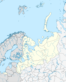
| Map | |||||||||||
 | |||||||||||
| Runways | |||||||||||
| |||||||||||
Maysionvara is a former Russian air base 22 km north of Suojarvi.[1] A 1962 US satellite analysis showed a 2560 m (8400 ft) runway with no aircraft on the field.[2]
References
[edit]- ^ RussianAirfields.com listing.
- ^ MISSION COVERAGE INDEX MISSION 9050 15-18 DECEMBER 1962, November 1, 1963, CREST: CIA-RDP78B04560A001200010020-3, Central Intelligence Agency, Washington, DC, p. 10.

